33
E M E R G I N G T E C H N O L O G I E S
R E S E A R C H @ H K U S
RECONSTRUCTINGTHE
WORLD IN 3D
Through research into computer vision, the huge amounts of
visual data now available are being usefully mined and set to
work. This is being achieved through the development of algo-
rithms and technologies for applications such as 3D mapping.
With such guidance, we would locate destinations not by today’s
2D charts filled with geographical symbols but by our mobile
phones equipped with GPS and its visual sensor, the phone
camera. Terrain could be known beforehand, assisting rescue
missions and expeditions. Urban locations would be revealed
as they actually appear, making getting lost in a strange place a
thing of the past.
Computer vision expert Prof Long Quan has spent the past
two decades driving forward the fundamentals of 3D reconstruc-
tion. He was involved in theoretical developments in the 1990s,
contributing to many fundamental 3D vision algorithms, includ-
ing the minimum six-point algorithm from three views and pro-
jective reconstruction from multiple views. He also participated
in the practical side of 3D modeling by integrating computer
graphics algorithms. Since joining HKUST in 2001, he and his
team have made exciting advances that include a fully automatic
3D reconstruction methodology from very large numbers of
images, and recent algorithms and systems to address the “miss-
ing detail” challenge of current technology.
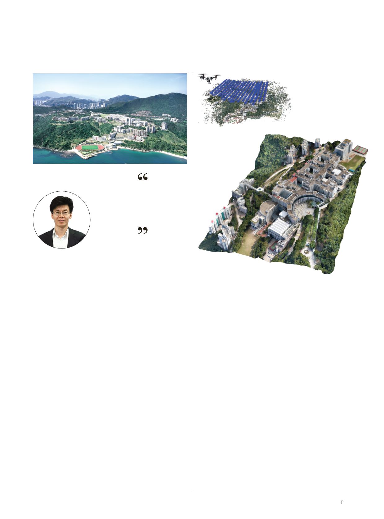
Left: A drone autonomously
captures images of the HKUST
campus.
Below: 3D mapping technology
is used to reproduce images of
HKUST campus from different
angles.
In this latest move forward, 3D details at ground level that
could not be captured before using street-view camera cars, such
as side views of buildings, are now made possible by unmanned
aerial vehicles (UAVs) and can be merged with low-flying aerial
views by fully automated methodologies. The enhanced accu-
racy this development has provided has created interest among
global peers and major companies, including Google, Airbus and
Mainland China businesses, Prof Quan said.
Given his focus on visual 3D reconstruction of landscapes,
and visual data analysis, Prof Quan is also involved in helping
machines understand and recognize what they are seeing. This
could be buildings or trees, or whether an object is man-made or
vegetation. Such research is intrinsically linked to UAV techno-
logy, part of the University’s targeted research excellence area of
autonomous systems and robotics (see “Flying High” P24). The
UAVs and their cameras allow the capture of a large amount of
unoccluded visual data for recognition and monitoring as well as
3D reconstruction. HKUST computer vision researchers are seek-
ing to provide autonomous system researchers with better tools
to analyze what they are capturing.
In addition, given the capability of 3D measuring, the work
heralds a likely revolution in photogrammetry, the science of
making measurements by using photographs, often aerial ones,
to survey and map terrain. In line with this, the HKUST start-up
launched by Prof Quan’s group has recently enabled the online
cloud platform, altizure.com, through which the ambitious objec-
tive ofmapping theworldusing drone photographsmay be realized.
HKUST campus
PROF LONG QUAN
Professor of Computer Science and
Engineering, and Director, HKUST
Center for Visual Computing and
Image Science
3D reconstruction from
photographs is not the end.
It is the beginning!


